|
| Somewhere in the Georgia mountains. Photo by me, October 2024. |
In typical fashion, the last week of October
near Halloween is when I drive up to the mountains of Georgia or North
Carolina to see the peak leaf color, go for a hike and buy locally
grown Georgia apples and apple cider doughnuts. These are trips I have been making since the 1980s.
One of my destinations in October 2024 was a little known waterfall that I had found in a hiking book from the 1990s. There are many waterfalls in the Georgia mountains and in the fall, the mountain trails are crowded, especially on weekends. I call it the tourist circuit in which metro Atlanta residents drive up to the mountains, fill up the trailheads and huff and puff through the woods for a selfie in front of the water falling over the rocks. The peace I associate with the mountains is nonexistent during fall weekends and the last thing I want to do is listen to people drowning out the sounds of nature.
To help prevent this location from falling victim to the overcrowding of the tourist circuit, I am not going to name this waterfall or its specific location. There is very little information on the internet about this trail and waterfall and I do not want to contribute to it being overrun like most every other place.
 |
| The snaky road with sneaky curves. Photo by me, October 2024. |
To hunt down this waterfall and lightly traveled trail which I feared might be overgrown, you drive a twisting and narrow two lane state road into the Chattahoochee National Forest. After passing over the tops of ridges for many miles there is another turn onto an even more narrow and curvy road that follows a gap between the ridges. Several miles down this road and following directions from thirty years ago we turned again down a gravel and mud Forest Service road. There were no signs indicating there was a trail or waterfall to be found. The road was in decent shape for an unpaved Forest Service road given that it was only a month since Hurricane Helene had barreled through the mountains and caused so much destruction. Also, you never know what conditions to expect on Forest Service roads as some are more treacherous than others.
 |
| Shall we drive this Forest Service road through a creek? Photo by me, October 2024. |
The gravel road followed a creek upstream into a mountain cove for some time before we guessed we had located the trailhead by a small pullover as again there were no signs.
 |
| Tempted by the unmarked path. Photo by me, October 2024. |
A trail peeked at us through the brush and we decided to take it with no one else around to tell us that we could be making a mistake. Not that I cared, I was happy to be having an adventure in the woods just as I had since I was a boy. Up the cove we walked between the ridge tops that ranged between 3,200 and 3,400 feet in elevation.
 |
| A bigfoot. Nah, just me. Photo October 2024. |
We walked for some time as the cove began to close in around us. It was around that time and after trudging through a long muddy stretch that I suspected we might be on the wrong trail or that the directions from a thirty year old book were wrong. I sensed that the person I was with began to question our direction and was hesitant about continuing. I assured him that it was not much further and to keep following the swift moving creek upstream, not that I had any real clue. We were going to find something even if it was a bear and we had earlier heard something crashing through the underbrush and leaves on a ridge above us. Though the thousands of wild black bears in Georgia are mostly afraid of human contact and will run away, I hoped not to test it.
It was the sound of the waterfall in the distance that we heard first and with that, our pace quickened. The boundary of two counties went unseen between our legs as we straddled it.
 |
| A place with history under the fallen leaves. Photo by me, October 2024. |
The ground leveled out and we were standing in the spot of a former Civilian Conservation Corps camp from the 1930s. From looking around, there were signs that on rare occasion people still used the area to tent camp. Those people too were as lucky as us to know about this almost secret place that on this day we had completely to ourselves.
 |
| Some of the old mill ruins from over a hundred years ago. Photo by me, October 2024. |
Prior to it becoming a C.C.C. camp almost a hundred years ago, there had been a family mill located just below the falls. A few ruins of the mill were scattered around.
 |
| The rooted and rocky trail to the ledge. Photo by me, October 2024. |
The waterfall crashed through the foliage and remained hidden from view from the banks of the creek. There were two options to be able to view the falls: wade into the cold October mountain water on slippery rocks or crawl up a rooted, rocky ledge then on hands and knees inch out to the edge. It if had been July or August I would have stripped down and chosen the water route. Since it was almost November and from experience I know how cold mountain streams can be even at the height of summer, I forced my too-old-to-be-doing-this-self up onto the ledge.
 |
| Between the mountain laurel the secret waterfall runs. Photo by me, October 2024. |
The view was worth it and was made even more beautiful since we had it to ourselves with no other humans around for miles. There was no line of selfie takers, chatter about lives lived by the glow of a cell phone aimed at the face and no alerts or noise masquerading as music blaring from cheap speakers. This was not an experience to be checked off from a list and forgotten. There was nature as it should be enjoyed with a present mind and a satisfaction of finding its beautiful secrets that has driven me since I was a young boy in the 1970s.
 |
| The moon of the mountains nearing Halloween. Photo by me, October 2024. |
On the way out of the cove to the gravel road, the weather turned as it does in the mountains like flipping through the pages of an old hiking book. Sunshine became cloudy and would become rain later. Clouds with small cracks between coagulated in the sky with my thoughts, the temperature cooled and the moon signaled from above the limbs that nightfall lurked. Ichabod Crane on a lonely country road entered my thoughts as I looked at the trees leaning over the road. The stories of The Headless Horseman and The Legend of Sleepy Hollow inflamed my imagination as a kid and still I remember the eeriness of that dirt road behind my childhood home as something sinister decades later. Not all of my childhood Halloweens were spent running with untied shoe laces from spooks and birds or hearing my grandmother relay news stories of razor blades hidden in the apples. I suppose there is a little of Washington Irving's characters in me, both Ichabod and Rip Van Winkle, and when in the silent woods on October evenings my imagination taps me on the shoulder.
 |
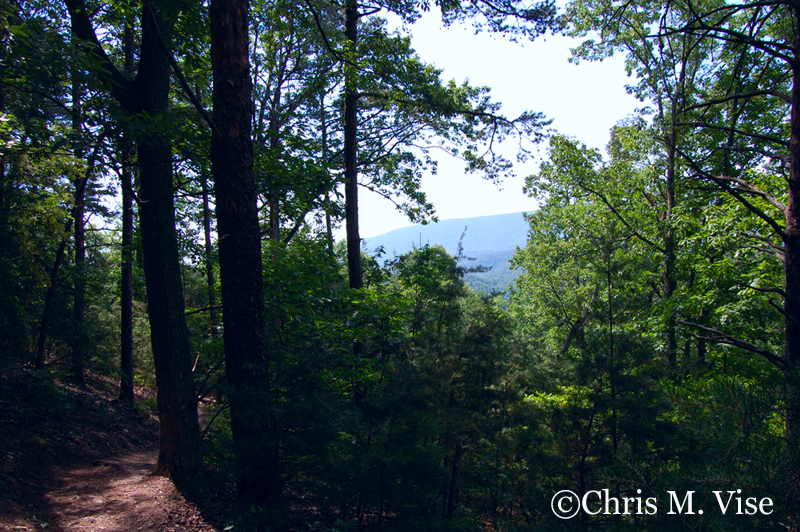
| Photo by me, October 2024. |
Where the road meets the trail and forks into our imagination if we are lucky.