Wednesday, December 7, 2016

Tumbling Waters

Photo by me, September 2014.

Amid the mountain laurel that makes up part of the dense green forest and next to a small pond I started the hike up to Amicalola Falls. It was the second day of September so it was going to be a hot and humid hike that climbs straight up this mountain to the waterfall. Hiking in Georgia in the summer is like hiking in a jungle with the thick forests, thick humidity and high temperatures. So as always bring plenty of water and watch for the snakes.

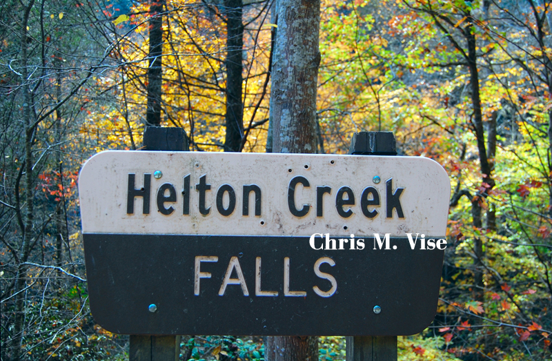
Amicalola State Park is located in far northern Dawson County near the Gilmer County line. The state park offers a lodge, restaurant, camping, hiking some steep terrain and the highest waterfall in Georgia, Amicalola. It also offers an approach trail to the Appalachian Trail that has convenient parking and a trail to the secluded Len Foote Hike Inn.

Like much of northern Georgia this area was once home to the Cherokee tribe of North American Indians. That's why so many places have been given Cherokee names or at least English translations of the Cherokee words. Amicalola is one of those places with a Cherokee name and is translated to mean "tumbling waters." Cherokees were in control of this land until the 1830s when the U.S. government forcibly removed them from their ancestral lands in the 1830s in the Trail Of Tears.

Photo by me, September 2014.

So onward I went up the approach trail to the Appalachian Trail and this is how it went.

Photo by me, September 2014.

Photo by me, September 2014.

Photo by me, September 2014.
 
Photo by me, September 2014.

Photo by me, September 2014.

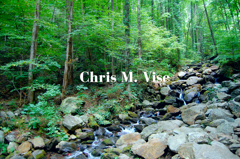
The trail begins at 1,800 feet above sea level in elevation and rapidly climbs to 2,500 feet in a very short distance. Though this is a very challenging hike with the elevation climb if you go the entire way to the the top of the waterfall I thought this was a beautiful trail. The understory in late summer was filled with wildflowers and the trail takes you alongside the boulder filled Amicalola Creek part of the way.

Photo by me, September 2014.

Photo by me, September 2014.

Photo by me, September 2014.

Photo by me, September 2014.


To me hiking isn't about the destination whether it is getting to the top of the mountain or the waterfall but what you see and experience along the way to that destination. Hiking isn't a goal oriented activity where the outcome has to be a reward like a great view or so many miles at the end of the journey but is about appreciating the beauty all around you in nature with every step you take.

"Remote for detachment, narrow for chosen company, winding for leisure, lonely for contemplation, it beckons you not merely north and south, but upward to the body, mind and soul of man." Harold Allen.

I was reminded of that quote by long time Appalachian Trail volunteer Harold Allen when thinking about what I enjoy about hiking and taking every step and the discoveries we make in nature and about our own human nature. A good way to find yourself is just be yourself alone in the woods and hopefully you will return a better person for the journey. I know that for myself I am most at peace and most alive in the woods.

Photo by me, September 2014.

Once you begin nearing the waterfall the trail turns into stairs. These stairs will take you up to a bridge directly in front of and over a portion of the falls. Standing there you can feel the cold water and get sprayed with mist which is a great way to cool off after all that climbing.

Photo by me, September 2014.

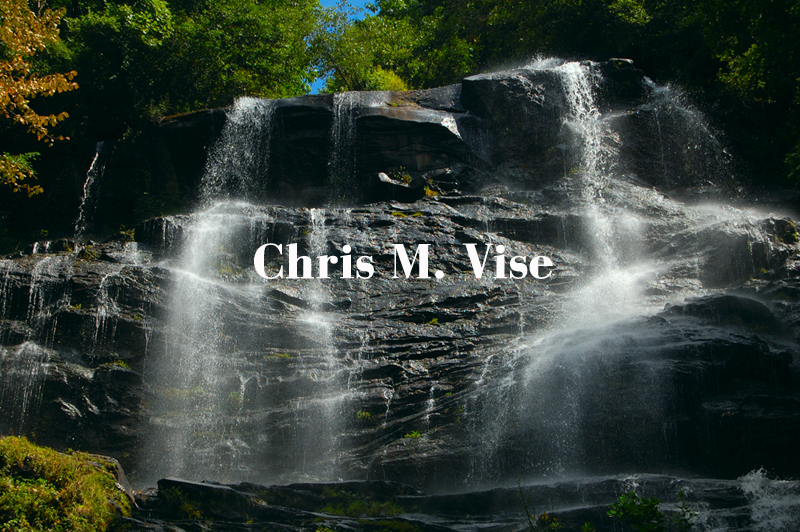
Amicalola Falls is a 729 foot drop (the highest in Georgia) of white water off the face of the mountain. It is an incredibly beautiful sight and worth every bit of effort to get up and close to. With some of the waterfalls in Georgia you can stand under or climb on them but not this one. The risk of serious injury or death would be too great venturing off the trails and playing in this waterfall.

Photo by me, September 2014.

Now after admiring the power of the waterfall you can head back down to the parking lot or you can continue your hike to the very top of the waterfall. Once at the top you can peer right over the edge of the falls. Also at the top is another parking area and the lodge and trails continuing on to other destinations. If you have the energy and want to see a view from the top then be prepared for lots more climbing. In cool weather such as late autumn or winter the climb is easer but, in the heat and humidity the rest of the year this climb is more arduous than one might think.

Photo by me, September 2014.

Photo by me, September 2014.

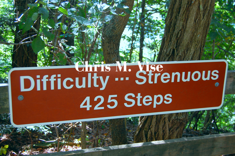
The stairs go so far up that mountain that in the summer you cannot even see the top of the stairs. In total there are 425 steps to climb to get the rest of the way up the mountain. No matter how good of a shape you are in this is a serious climb in high heat and humidity so consider that before attempting this. For perspective there are 1,576 steps to the top of the Empire State Building in New York, this climb is slightly more than a quarter of the way to the top of that building.

Photo by me, September 2014.

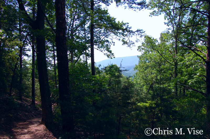
As you start nearing the top of the mountain you begin to break free from the tree canopy and you can see views of the surrounding ridges.

The foliage nicely frames the view. Photo by me, September 2014.

Photo by me, September 2014.

Once at the top you can peer directly over the edge of the waterfall and the cliff. Through the opening of the trees you can see the valley below and other mountains in the distance. A more open view of the surrounding landscape can be found over the at the lodge and restaurant a short walk away.

Photo by me, September 2014.

Photo by me, September 2014,

If you want to keep hiking you certainly can, all the way to Maine or back down to Springer Mountain which replaced Mount Oglethorpe, Georgia as the beginning of the Appalachian Trail in 1958.


Sunday, November 27, 2016

Helton Creek Falls

October 2016. Photo by me.


D

eep in the North Georgia mountains in Union County on the edge of the Blood Mountain Wilderness and inside the Chattahoochee National Forest surrounded by mountains over three and four thousand feet, runs Helton Creek. Helton Creek is one of many creeks that drain through this narrow passage between these mountain ridges. The water flows to create not one but two waterfalls that can been viewed at the same stop.


On the final day of October I took my annual fall foliage trip through the mountains to view the colors, buy apples, do some hiking and relaxing away from the city. This was my first visit to Helton Creek Falls. Autumn, in particular October, is the lowest month for rainfall in North Georgia and coupled with a severe drought I expected the water flow would be minimal.

Helton Creek Road. October 2016. Photo by me.


Fall foliage at the trailhead. October 2016. Photo by me.

 
Driving to Helton Creek Falls is a bit of a challenge and you can easily miss the turn onto Helton Creek Road from U.S. Highway 129. Helton Creek Road is a narrow and winding gravel road with several blind curves and the forest grows to the edge of it. It is possible for two cars to pass side by side, but it is close comfort and one car is going to have to give way and precariously pull off to the side which has no barriers. If you approach Helton Creek Road or exit that direction to Georgia Highway 348 north of Helen you will drive through two creeks so having a high clearance vehicle is suggested. Also for consideration, in this remote location do not expect to find much in the way of cell phone service for emergencies. Isolation comes at a price, but this is worth it.

From the trailhead you can see one waterfall in the distance. Photo by me, October 2016.


At the trailhead there is limited parking on the side of the road that might have a capacity for five to six vehicles. From the parking area you can see one of the two waterfalls when the tree cover is scarce in late fall and winter, but in the summer that would not seem possible.

The first of the two waterfalls. October 2016. Photo by me.


Mountain laurel frames both sides of the waterfall. Photo by me, October 2016.

The trail to the first waterfall is a little steep and there are plenty of roots making good shoes a necessity. In wet conditions for someone not in the best of shape this might be a perilous walk. However, the walk is brief, lasting five minutes at most.

The viewing platform. Photo by me, October 2016. 
The view of the second waterfall from the platform. Photo by me, October 2016.

To get to the second waterfall you continue on the trail and this walk is more difficult. Even in a drought the trail was wet from water seeping out of the ground and from Helton Creek. There are also even more roots to create potential hazards going up the incline. Once beyond the incline the trail levels off and there is a wooden viewing platform to the second waterfall. This second waterfall is larger than the first one.

To get a sense of scale you can see the waterfall compared to the average size person. Photo by me, October 2016.

Photo by me, October 2016.
Photo by me, October 2016


At the second waterfall you can enjoy the view from a wooden platform. You can also walk around the platform onto the rocks and into the creek for a closer look when water flow is this minimal. The plunge pool is much larger and the drop is higher at this waterfall as compared to the first one.

I can only imagine how much more scenic these waterfalls would have been in a normal weather pattern without the severe drought that Georgia experienced in 2016. Even so, Helton Creek Falls is a beautiful and serene place off the beaten path from the more notable Georgia waterfalls.


Saturday, November 26, 2016

Hiking Pine Log Creek

This might be the best view on this hike. Photo by me, May 2016

By late June I know that hiking in the south is more hard work than pleasure until the cooler weather in late September begins to return. It was Memorial Day weekend of 2016 and I knew it was already getting uncomfortable this year to be climbing hills and pushing on for more miles but I did it anyway. I had planned this hike near Rydal, Georgia for a couple of weeks so despite a weather forecast of temperatures near 90 and the humidity making it feel closer to 100 degrees I was determined to head out that morning.

Shall we go for a hike? A foot bridge over Pine Log Creek. Photo by me, May 2016.

Go high or go low? At some trail junctions you just have to guess which way to go. Photo by me, May 2016.

The entire trail system at Pine Log Creek consists of just over four miles spread out over the east and west loops, the approach trail and the quarry trail. Four miles isn't that much of a hike in my estimation but when the trails are in many places cut straight up hills with few switchbacks then those four miles are much more difficult than they should be.

C.C.C. quarry. Photo by me, May 2016.


The highlight of this hike is the C.C.C. (Civilian Conservation Corps) quarry. So if the works of the C.C.C. interest you then this makes this a worthy hike. The quarry now filled with water is a tranquil place and a good spot to take a rest and climb around on the large boulders. I would be careful of snakes here as I saw several slither into the water while I was exploring the quarry.

One of the few views on this trail. In the far distance to the southeast is Pine Log Mountain. Photo by me, May 2016.
You never truly break free from the tree canopy on this trail. Photo by me, May 2016.


The trail system here isn't much different than the woods you might find out behind any suburban Atlanta home. The highest elevation on the trails is just over 1,200 feet above sea level. The scenery aside from the quarry isn't remarkable. The trails as badly as they are cut are straight up and down hills with few switchbacks during the elevation gains and the views are only minimal as you never break free from the thick tree canopy. I would consider this trail system more of a fitness trail or a nature walk than a hiking trail for scenic views.

One of the copperhead snakes I saw that day. Photo by me, May 2016.
A gray rat snake that crossed the trail in front of me, Photo by me, May 2016.


Again watch for snakes here in warmer weather. I encountered two copperheads and a gray rat snake on the trails and on the rocks by the quarry.

This dead tree was directly over the trail just waiting to take out someone. Photo by me, May 2016.
Up near the top of the trail there are lots of short needle pines blocking any view. Photo by me, May 2016.


I did have a bit of bad luck on this hike. About thirty minutes in my hike I dropped my water and it all spilled out onto the forest floor. I was already too far into the climb to head back to the car, get the rest of my water and start the hike over. So I forged ahead without water the rest of the day and that made for one long hike in that weather. By the time I got back to the car I had a headache probably due to dehydration and couldn't drink the water quick enough. This was another reason for me to not enjoy this hike that day.

A tree with a disease. I thought the diseased growth looked like a human brain. Photo by me, May 2016.
Some color in the understory of the woods. Photo by me, May 2016.
Sometimes when the hike isn't giving you great views you have to look a little closer to the ground to find the beauty. Photo by me, May 2016.
Photo by me, May 2016.

Count the tree rings. Photo by me, May 2016.
The namesake of this trail system, Pine Log Creek. Photo by me, May 2016.
 Despite the weather, the lack of drinkable water and views it was still a day of appreciating nature and finding beauty in small doses. So I would never discourage anyone from taking a walk whether it is in the middle of the city or in the middle of nowhere as it is the best thing you can do for the mind.

The Pine Log Creek Trail system is located off Highway 140 near the town of Rydal on the Bartow and Cherokee County line. From Atlanta the drive is about an hour north depending on traffic and construction. There is no fee for parking.