Saturday, September 15, 2018

A September Saturday Morning


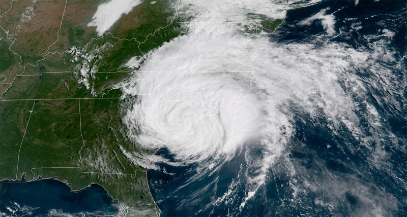
Hurricane Florence this morning.


The sun is blazing and it is hot this morning. The wind is beginning to stir on the last remaining days of summer this Saturday. We here in Atlanta await the remnants of Hurricane Florence which is still over in South Carolina and moving ever so slowly this way. The rain will come, but not so heavily and the wind will blow and at least it will be cooler for a day and maybe two. I am looking forward to the rain.

It has been some time since I sat down to write here even though I have been thinking about it. I could say that I have been too busy and it is true that I have been busy with life and whatnot. I guess I have just been thinking about the 90s and how I miss them. I miss life before the internet and cell phones saturated modern living and so I have been staying away from here to think.

Last night standing outside talking to my neighbor until it was too late, after midnight, we talked about society on a hot and humid night. He's younger than I am, in his 20s, and even though he was alive in the 90s he was only a child so he cannot appreciate the differences in life and society as it is today compared to the 90s. I said something about how I felt that people were too serious these days and I don't think he could fully grasp what I was talking about.

But...I do miss those days without cell phones and limited internet access.


Saturday, August 18, 2018

Enigmatic Miami

Miami. Photo by me in 2009.

Several times over the last nine or ten years I have traveled to Miami and each time I leave I still feel like I do not know the city any better than I did before. Part of me wants to love this city carved out of the swamp and perched next to the ocean on the southeast corner of the state, but I cannot love something I do not know.

Miami is a mystery to me that comes wrapped in sandy beaches, glistening waters and shiny towers pulsating in a rhythm and energy that unsettles me. The city has the most aggressive drivers I have ever seen - worse than New York, Atlanta, Washington, Chicago or Los Angeles. Maybe it is all that hot sunshine boiling the atmosphere that removes patience from the human mind? Driving on I-95 or any street in that city is an education in seeing how quickly a car can be maneuvered through traffic and miraculously squeezed into the narrowest of gaps. It is more than the driving that perplexes me about Miami, it is the entire city that feels so anxious, on edge and violent as if cocaine is swirling on the sea breezes.

In an effort to better understand Miami I decided to read Joan Didion's book called Miami in hopes that it might give me a better idea of what I am missing from my own experiences in the city. Didion's book published in 1987, which I read over the last couple of weeks while traveling the American West and finished back at home unfortunately was not the book I hoped it would be. Miami is a book that is narrowly focused on the history of Cuban exiles and how they have influenced South Florida since the 1960s into the 1980s. The book is good at examining the key players in the Cuban exile community since the 1960s and their activities here in the U.S., Cuba and Central America, especially Nicaragua, but it never steps outside those bounds to provide a larger take on the city as a whole. If you want to read about guerillas training in the Everglades, bombings, the Bay of Pigs, clandestine CIA operations and U.S./Cuban politics then this is a great book for that. If like me, you were wanting a broader view of a Miami and its people this is definitely not the book to provide such a background.

I will have to keep looking for a book that will help me better understand what it is I am missing from my own experiences in Miami. In reading Miami the most interesting piece of information that I learned about was a temporary art installation by artists Christo and Jeanne-Claude in 1983. I was ten years old at the time so I must have missed out on seeing this on the television news or I simply do not remember it, but this was a large scale installation that would have made national headlines at the time. The installation was called Surrounded Islands and was incredible.

Surrounded Islands 1983. Image courtesy Christo and Jeanne-Claude.

The installation consisted of surrounding eleven islands in Biscayne Bay with floating pink polypropylene sheets. It would have been beautiful to have seen this in person. Prior to this I only knew of Christo and Jeanne-Claude from a documentary I had watched several years ago about their temporary installation known as The Gates of Central Park in 2005.

Though I may not have enjoyed Didion's book about Miami I do have her to thank for exposing me to Surrounded Islands. Here's a link to a 2018 story from the Miami Herald looking back on Surrounded Islands thirty five years later.

Sunday, June 10, 2018

High Falls, Alabama

Photo by me, July 2016.

As with most places in Alabama, High Falls waterfall is in the middle of nowhere in the northern part of the state a few miles east of the Tennessee River. Once you turn off the main road you find yourself driving between large fields, chicken farms and down narrow little roads that are more like lanes but at least they are paved. This waterfall is off the beaten path even by Alabama standards and is not all that well known outside of locals but it is worth a visit.


Photo by me, July 2016.

A walk down a path from the parking lot, through a picnic area and you emerge through the tree canopy to find the waterfall from an overlook. Unfortunately, when I came it was the driest time in summer and the water flow was low. So what is probably a beautiful waterfall in more wet weather was little more than a small trickle cascading thirty-five feet over the rocks into a pool below. It was so dry that the view was more of a rocky cliff than a waterfall. I recommend coming after a heavy rain or in the winter if you want to see more water gushing over the cliff.

Photo by me, July 2016.

Still the lack of water did not deter people from enjoying the rocks to jump down into the pool of water below. With the lack of raging water this was actually a great place to go swimming on a hot summer's day.

Photo by me, July 2016.

As you can see the water here in Town Creek is very shallow as it approaches the waterfall and you can easily walk out to the edge without getting swept away when the water is low.

Photo by me, July 2016.

The calm waters were reflecting the sky well on a hot July day.

Photo by me, July 2016.

To have a better view of the landscape there is a pedestrian bridge above the waterfall.

Photo by me, July 2016.

Prior to the current bridge there had been a covered bridge that spanned the shallow creek. As with some many things, especially covered bridges, the bridge was lost to time and burned in the 1950s.

Photo by me, July 2016.

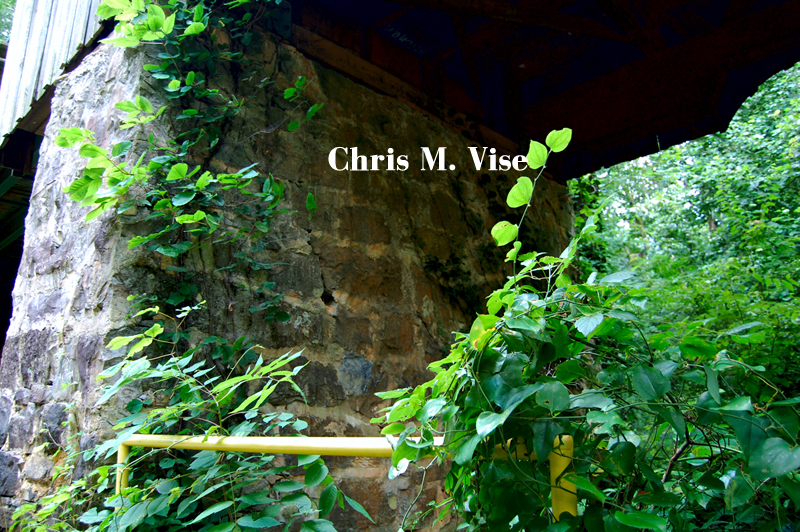
The only remaining portions of the covered bridge are the original stone support pillars from the early 1920s.

For more information and directions to this out of the way place you can go here.


Thursday, June 7, 2018

Euharlee Covered Bridge

Photo by me, July 2017.

July of last year I was loafing around Northwest Georgia and stopped in the town of Euharlee in Bartow County to see the Euharlee Covered Bridge. It had been a long time, probably the early 1990s, since I was in this part of Bartow County and I was surprised by the growth. It seems the natural beauty that I have long admired about this county is slowly being plowed and paved over by sprawl fanning out from Atlanta. People have long said that it was eventual that the area between Chattanooga and Atlanta was to become one long morass of sprawl and I believe it. Enjoy the natural beauty of these areas while you can before it becomes subdivisions and shopping centers.


Photo by me, July 2017.

A brief history of the area notes that Euharlee became an incorporated town in 1870, but European settlers were in the area for at least four decades prior and Native American Indians for a much longer period. Bartow County was created in 1832 and originally named Cass County. It would not receive its current name until 1861 when the namesake General Lewis Cass opted to support the Union.

Earlier bridges over Euharlee Creek had first occupied the spot of today's covered bridge. The last one, before the covered bridge was erected, collapsed in 1871 killing two men on a wagon.

Photo by me, July 2017.


The covered bridge was constructed in 1886 and has a length of 138 feet. The bridge was in use until the late 1970s, but cars now use a nearby concrete bridge.

Though I grew up in neighboring Paulding County, we spent significant time in Bartow County. We camped at Lake Allatoona and took Sunday car drives in the area in the 1970s. Given my age at the time I do not specifically remember crossing the covered bridge, but I suppose it is possible.

Photo by me, July 2017.

The bridge is of the town-lattice design which is the common type of covered bridge found in Georgia. The timber used to construct the bridge is pine.

Photo by me, July 2017.

The supports underneath the bridge are made of stone.

Photo by me, July 2017.

Looking up at the underside of the bridge you can see the crisscross  pattern of the beams.

Photo by me, July 2017.

Walking across the bridge you can see daylight coming up through the wood treads and the creek down below.

Photo by me, July 2017.

Adjacent to the bridge are the ruins of the Lowry Grist Mill which predates the town and covered bridge. The mill was built by Nathaniel Burgess in 1834 and later sold. The eventual owner was Daniel Lowry II.

Photo by me, July 2017.

Today, all that remains of the old mill are the stone walls of the foundation.

Photo by me, July 2017.


There are other historical buildings remaining in Euharlee and even an old well. 

The natural beauty that remains in this part of Bartow County is worth seeing and so is the history that has been preserved. If you are a fan of covered bridges then Euharlee is a nice one to visit.

Friday, May 18, 2018

Desoto Falls, Georgia

Photo by me, May 2018.

Last Sunday I was up and out early to make the drive up to Desoto Falls in far northern Lumpkin County in the Blood Mountain Wilderness. Desoto Falls is located just south of the Appalachian Trail crossing on U.S. Highway 19 at Walasi-Yi.

Photo by me, May 2018.


Desoto Falls is named after Spanish explorer Hernando de Soto who is said to have explored this area in the 1540s. Now it is without a doubt that de Soto did explore many parts of Georgia including the North Georgia Mountains in the 1500s. Hernando de Soto is considered to be the first European to explore the interior portions of the southeastern United States. Historians do have a good idea from the expedition records where de Soto's party explored but there is no exact route known where he did travel. So to claim that armor that was found near the waterfalls is from his party does make for an interesting legend but the claim may be dubious. Nonetheless, Desoto Falls is named after him just as the Desoto Falls in Alabama is too.

Never in my time in the woods have I encountered warnings of "people have died" here and other warnings of potential death, that was until I visited Desoto Falls in the mountains of North Georgia.

The sign above in the photo states, "several people on the waterfalls and fallen to their death." Note that it says several.

This is one of those people that have unfortunately died at Desoto Falls by falling to their death. He was a teenage boy from Virginia that was camping with his family at the campground at Desoto in 2013. He disappeared from their campsite at night and was found the next morning at the bottom of the falls dead.

Photo by me, May 2018.

Yet another sign warning visitors that people have died on these waterfalls by being careless. This sign is at the base of the largest waterfall at Desoto. You might notice the cross on the sign with the blue ribbon. The name on the cross is of the person that I mentioned above that died here in 2013.

With all the posted warnings here you might think Desoto Falls would be the most dangerous place in the state, but it is no more dangerous than any other place out there in the woods. As with any time you spend out in the woods you should always exercise cautious judgement and common sense but most of all enjoy yourself. Nature is wild and can be unpredictable so taking unnecessary risks may result in injury or death any time you set foot into the woods. Accidents will happen and never will you be able to safeguard against every hazard, but you can use common sense to help minimize your risks.

That being said, Desoto Falls is no more dangerous than any other waterfall out there. Yes, it is a huge waterfall and people have died there but you can easily fall and kill yourself on a small waterfall too on the slick wet rocks. So do not let the deaths and warning scare you away from visiting Desoto because it is safe if you use common use and stay on the trails.

Photo by me, May 2018.

If the warnings of death by falling were not enough to scare you, there are the bears that might get you. I saw two warnings posted about bears being active in the area. In the North Georgia Mountains this type of warning is not uncommon to see especially in area near campgrounds where there is food. In all my time hiking and camping in these mountains I have yet to encounter a bear, outside of the Smokies, but I know that eventually I am going to see one. Bears generally do not like humans and will often run away if you make enough noise. Yes, it is possible you might see a black bear out there and if you do here is good advice.

After all the warnings and a little history let's get started on the hike.

Frogtown Creek. Photo by me, May 2018.

The trail leaves the parking lot then passes through a picnic area, follows a paved road along the edge of the campground and then you come to your first water crossing via a bridge over Frogtown Creek.

The last bridge before reaching the upper falls. Photo by me, May 2018.

Once across the creek there is a directional sign pointing you to the trail on the left for the lower falls and to the right for the upper falls. The signage also notes that from that spot it is one quarter of a mile to the lower falls and three quarters of a mile to the upper falls.

The trail to the upper falls. Photo by me, May 2018.
On the way back to the trailhead. Frogtown Creek is on the left with campground adjacent to it. Photo by me, May 2018.

I decided to do the longer hike to the upper falls first because fewer people were going in that direction. This trail has a couple of additional water crossings via bridge but mostly it follows an old logging road on a gradual climb to the falls. Frogtown Creek will be on your right most of the way to the falls.

The serene and dense forest along the trail. Photos by me, May 2018.


The trail is wide on the old road and an easy hike even in hot and humid conditions on the day that I hiked it. If you are in decent shape you will have no issues on this hike. The trail passes through a dense forest that is relatively young with tall slender timber and thickets of rhododendron in the understory. I strongly advise staying on the trail because it would be very easy to get lost if you wandered too far from the trail into the steep terrain of the Blood Mountain Wilderness.

Photo by me, May 2018.

This is the upper falls and middle falls - a multi-tiered waterfall that plunges off the side of Rocky Mountain.

As with most all waterfalls in the Georgia the amount of water flowing is going to be less in the late spring into the early fall. For the best viewing experience in terms of higher amounts of white water the late fall, through winter and into early spring are the best times to view them.

Photo by me, May 2018.

There was a wooden viewing platform at the base of the waterfall but it was destroyed by Hurricane Irma in September 2017. All that remains now are the concrete base supports.

Photo by me, May 2018.

Now if you wish to go further up the side of the waterfall, the trail is open according to the U.S. Forest Service. There was no sign or barrier to prevent you from going further up this narrow trail to the very top of the waterfall. This trail had been closed for many, many years after damage from snowstorms and hurricanes but it is considered open now. I opted not to go to the very top.

Now to get to the lower falls which are on another creek and not Frogtown Creek you have to retrace your hike back to the first bridge where the directional sign is located. The trail to the lower falls is one quarter of a mile long.

This trail caught me off guard as to how steep it is even if it is a short trail. This trail rapidly climbs the side of the mountain through a series of switchbacks and stone stairs. This trail is nothing like the easy trail to the upper falls.

Photo by me, May 2018.

From a set of stone stairs looking down the side of the mountain. There were several large trees that were felled during Hurricane Irma that had to be cut and removed off the trail.

Hurricanes and snowstorms can do a lot of damage to the Georgia mountains. Related to to this, here you can see some landslides that I witnessed just north of Helen last year after Hurricane Irma on Georgia Highway 17.

The lower falls. Photo by me, May 2018.

The lower falls once you arrive are smaller than the other waterfall but it is still impressive in person. The wooden viewing deck is still intact here and there are benches to take in the view and rest.

Desoto Falls is a popular destination so despite the potential dangers it is very much worth visiting. The hikes here are relatively short and easy and you can see two waterfalls in one stop.